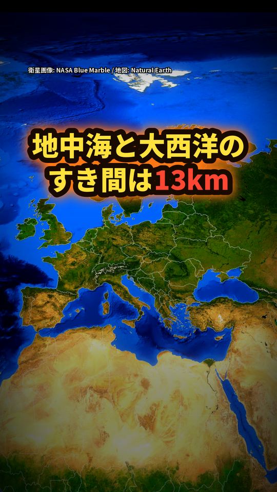
ジブラルタル海峡:地中海と大西洋のすき間は13km
答え
地中海が大西洋(世界の大洋)とつながる自然の出入口は、スペインとモロッコのあいだのジブラルタル海峡だけ(NASA:世界の大洋との間の唯一の自然のすき間。黒海などの内海とのつながりは別の話です)。いちばん狭い所で幅は約13km。地中海は東西に約3,700km、面積約250万km²あります。NASAの解説によると、約600万年前に地中海は大西洋から切り離されて干上がり、深さ約1,500mの盆地になったと考えられています(研究の見方で、年代は資料により約500万年前とするものもあります)。約30万年後に雨が増え、大西洋の水が流れ込み始めて今の海になり、その洪水は、アマゾン川の1年の流量の約1000倍(3桁大きい)の規模と計算されています。今も1日に約300隻の船が海峡を通ります。
動画で見る(YouTube・約1分)動画
動画で言ったことと、その根拠
動画の一文ごとに、確かめた資料の原文の該当箇所を引用しています。
長さ3700キロ
根拠:「The sea is about 3,700 kilometers (2,300 miles) long and covers about 2.5 million square kilometers (1 million square miles), while the Strait is only about 13 kilometers (8 miles) wide.」(The Strait of Gibraltar in 3D - NASA Science)
自然のすき間
根拠:「The Strait of Gibraltar is the only natural gap in the topographic barriers that separate the Mediterranean Sea from the world’s oceans.」(The Strait of Gibraltar in 3D - NASA Science)
ジブラルタル海峡
根拠:「a natural water channel connecting the Atlantic Ocean and the Mediterranean Sea」(The Strait of Gibraltar - NASA Science)
スペインとモロッコのあいだ
根拠:「At the strait’s narrowest point, Spain is only 13 kilometers (8 miles) from the coast of Morocco.」(The Strait of Gibraltar - NASA Science)
たった13キロ
根拠:「At the strait’s narrowest point, only 13 kilometers separate Europe and Africa.」(The Strait of Gibraltar - NASA Science)
大西洋と地中海をつなぐ、自然の水路
根拠:「a natural water channel connecting the Atlantic Ocean and the Mediterranean Sea」(The Strait of Gibraltar - NASA Science)
およそ300分の1
根拠:「The sea is about 3,700 kilometers (2,300 miles) long and covers about 2.5 million square kilometers (1 million square miles), while the Strait is only about 13 kilometers (8 miles) wide.」(The Strait of Gibraltar in 3D - NASA Science)
約600万年前
根拠:「nearly six million years ago, the uplift of the Gibraltar Arc System, in combination with changes in weather patterns around the Mediterranean, caused the area now occupied by the Mediterranean Sea to become disconnected from the Atlantic Ocean.」(The Strait of Gibraltar - NASA Science)
大西洋から切り離された
根拠:「nearly six million years ago, the uplift of the Gibraltar Arc System, in combination with changes in weather patterns around the Mediterranean, caused the area now occupied by the Mediterranean Sea to become disconnected from the Atlantic Ocean.」(The Strait of Gibraltar - NASA Science)
地面の隆起など
根拠:「nearly six million years ago, the uplift of the Gibraltar Arc System, in combination with changes in weather patterns around the Mediterranean, caused the area now occupied by the Mediterranean Sea to become disconnected from the Atlantic Ocean.」(The Strait of Gibraltar - NASA Science)
約250万平方キロ
根拠:「The sea is about 3,700 kilometers (2,300 miles) long and covers about 2.5 million square kilometers (1 million square miles), while the Strait is only about 13 kilometers (8 miles) wide.」(The Strait of Gibraltar in 3D - NASA Science)
すっかり干上がった
根拠:「Water that had become isolated from the ocean completely dried up and left behind an enormous, hot basin, approximately 1,500 meters (5,000 feet) deep.」(The Strait of Gibraltar - NASA Science)
深さ約1500メートル
根拠:「Water that had become isolated from the ocean completely dried up and left behind an enormous, hot basin, approximately 1,500 meters (5,000 feet) deep.」(The Strait of Gibraltar - NASA Science)
熱い盆地
根拠:「Water that had become isolated from the ocean completely dried up and left behind an enormous, hot basin, approximately 1,500 meters (5,000 feet) deep.」(The Strait of Gibraltar - NASA Science)
約30万年後
根拠:「Another study suggests that about 300,000 years later, precipitation increased, and water from the Atlantic Ocean began to flow into the basin, flooding it and producing the sea that exists today.」(The Strait of Gibraltar - NASA Science)
雨が増え
根拠:「Another study suggests that about 300,000 years later, precipitation increased, and water from the Atlantic Ocean began to flow into the basin, flooding it and producing the sea that exists today.」(The Strait of Gibraltar - NASA Science)
大西洋の水が、流れ込み始めた
根拠:「Another study suggests that about 300,000 years later, precipitation increased, and water from the Atlantic Ocean began to flow into the basin, flooding it and producing the sea that exists today.」(The Strait of Gibraltar - NASA Science)
およそ1000倍
根拠:「This flood event is calculated to have been three orders of magnitude larger than the yearly water discharge of the Amazon River.」(The Strait of Gibraltar - NASA Science)
アマゾン川
根拠:「This flood event is calculated to have been three orders of magnitude larger than the yearly water discharge of the Amazon River.」(The Strait of Gibraltar - NASA Science)
約300隻
根拠:「Today, the Strait of Gibraltar provides passage for approximately 300 ships every day, including fishing boats, ferries, cargo ships, and yachts.」(The Strait of Gibraltar - NASA Science)
出典
- NASA Earth Observatory「The Strait of Gibraltar」(Image of the Day、2023-06-18)https://science.nasa.gov/earth/earth-observatory/the-strait-of-gibraltar-151478/
- NASA Earth Observatory「The Strait of Gibraltar in 3D」(2003)https://science.nasa.gov/earth/earth-observatory/the-strait-of-gibraltar-in-3d-3926/
画像・音声の出典
衛星画像:NASA Blue Marble(NASA GIBS)/地図データ:Natural Earth
地図上の矢印・線・干上がりの茶色の塗り(Natural Earth の海域の輪郭)はおおよその位置・範囲です。国境は Natural Earth の表示で、領有の主張についての判断を示すものではありません。
VOICEVOX:四国めたん
効果音:効果音ラボ